THE FLIGHT OF A LIFETIME


This is my very first attempt at blogging so I hope this flows smoothly and we can all enjoy it.


This week, we (my best friend, co-pilot and wife) will be flying from Northwest Arkansas to Anchorage, Alaska via American Airlines to pick up Cessna 63082...a Cessna 150.


This plane was nicknamed "Mighty Mouse" some time back as this is no ordinary, run of the mill Cessna 150.

This is a 150-150 which means the stock Continental, 100 horsepower engine was removed and then upgraded to the Lycoming O-320 with 150 horsepower.

Additionally, Mighty Mouse has the full Horton STOL kit installed and 39 gallon long range fuel tanks.

Another big plus with this conversion is the 160 gross weight increase.

Mighty Mouse is a 1976 model with about 2,500 hours total time on the airframe and a new, zero timed, Lycoming factory rebuilt engine.


Here's a picture of Mighty Mouse in Alaska.


Cindy and I will be flying with (following actually) our good friend Terry Dickinson from Big Lake, Alaska.

Terry has two planes. One is a Piper Super Cub (on floats this time of year) and the other is a Cessna 152 which is affectionately known as Mosquito or......"Skeeter" for short.

Terry has a need/desire to reposition Skeeter to his winter home in the desert of Nevada and we (Cindy and I) have a need to travel with a highly experienced bush pilot (who also just happens to be a CFI) from the Alaskan wilderness, through the Canadian Rockies and on home.

Our generic plan will have us crossing back into the lower 48 at Great Falls, Montana and at this point (probably) we'll separate where Terry will turn right to the southwest and head to Nevada and we'll turn left to the southeast and head to Arkansas.


Here's Mosquito (Skeeter) parked next to Mighty Mouse at Big Lake, AK


All three of us consider this to be the ultimate flying adventure of a lifetime and we'll do our best to document this trip for not only our enjoyment but yours as well.


Jim & Cindy

Monday, June 23, 2014

Emporia, KS to Rogers, AR - "The Final Leg" - June 22, 2014

We departed Emporia, KS with the end of our adventure within spitting distance.....so to speak.  We flew this last leg in 1.7 hours still having to watch the weather as build ups were taking place throughout the region.

There was nothing in our line of flight that would stop us, although there was a build up that looked menacing off to our south west that made us divert about 20 miles to the east just for the safety factor.  I flogged Mighty Mouse for about an hour or so simply to guarantee a safe distance.....we were to close to get beat now.

Staying to the east offered better visibility and when I knew we had it made, I throttled back to a more mundane cruise setting and savored these last few miles of what truly was a trip of a lifetime.

We left Wasilla, Alaska on June 5 and flew 30.7 hours to home base in Rogers, AR where we landed on June 22.

My what a journey it's been.

And to Mighty Mouse.........you done good, Pal.


Jim & Cindy 


The transition from farms to the Missouri Ozarks take place rather quickly in southern Missouri....trees and hills begin to take over.


The visibility to the west was shrinking and storms were out there too as we closed in on the end so a left turn to the east helped matters quite a bit and enhanced the safety factor.  

Turning to the east and much better visibility that direction was the choice at hand assuring no complications on into home base.


And home base on the nose, a welcome sight for a couple of tired pilots....tired plane as well.

Short final for runway 20

We're almost there......just a few more seconds to touchdown.


And touchdown........Mighty Mouse has arrived in Rogers, AR

Here's our hangar and Mighty Mouse is put to bed following this very long trek from Alaska.  Our 152, Sierra, is here as well and Sierra is, well, quite the lady.  I would think Disney might be interested in another "Lady and the Tramp" picture cause this sure fits that mold.  Dang good job Mr. Mouse......dang good job. 

Valentine, NE to Holdrege, NE to Emporia, KS - June 22, 2014

We departed Valentine in north central Nebraska and flew GPS direct to Holdrege, Nebraska in south central Nebraska.  This leg was 1.5 hours and we witnessed the change from cattle country in the Sandhills to crop raising agricultural farms. 

After we refueled in Holdrege, we departed for Emporia, Kansas which would be the very last fuel stop of our long journey.  This leg was 2.0 hours and the end was now officially in sight.

I must admit we were getting tired of living on the road for so long and we truly looked forward to sleeping in our own bed tonight.....about another 4 hours of flying was all that stood between us and home.


Jim & Cindy


The landscape changed from ranches in the Sandhills to farms which grow what Nebraska is best known for........corn. 

Topped off in Holdrege, NE and departing for Emporia, KS

The very last fuel stop of the adventure.....Emporia, KS.  The landscape changed very little between Holdrege and Emporia and continued unchanged until we arrived at the Missouri Ozarks.

Mighty Mouse, fueled and ready for the last leg of this memorable adventure.  Who would have thought that such a plane could provide the transportation requirements for a trip of this magnitude. 

Aberdeen, SD to Valentine, NE - June 22, 2014

We departed Aberdeen, SD and headed to Valentine, NE where we would refuel.  Eastern Nebraska (to our southeast and original GPS direct path) had numerous active thunderstorms so we flew southwest to remain clear of the storms.

During this leg we crossed the Missouri River which meanders around up here as it heads to Saint Louis.

Valentine, Nebraska is cattle country and is located in what's referred to as the Sandhills.

This first leg of the day was a 1.9 hour leg.


Jim & Cindy  


Departing Aberdeen, SD to the southwest.....wrong direction to get us home but it's the safe way to avoid thunderstorms to the southeast.


This area has received quite a bit of rain including the storms from Saturday night.  We're so glad we found shelter for Mighty Mouse inside a hangar.

Flying over low, scattered clouds as we approach central South Dakota

Approaching the Missouri River

We could be doing this instead of flying.....but why????

Refueling in Valentine, Nebraska.  This is a very nice, country airport with everything we needed.

The Valentine, NE logo.  I understand that many Valentine Day cards are sent here every year so they can be post marked here in Valentine......nice touch.

Swift Current, SK to Minot, ND to Aberdeen, SD - June 21, 2014

We had another change of plans on Saturday morning (June 21, 2014) as we had planned to depart Swift Current and fly to Williston, ND and go through customs there.  When I called for a weather briefing, the Canadian briefer informed me that Williston was closed for the day for some runway maintenance so we could not land there.

I refiled my border crossing application (eAPIS) for Minot, ND and was given a new confirmation number and a clearance for departure to Minot.

This delayed us somewhat but we were airborne and I had given the border crossing agent an ETA of 2:00.  We flew 2.6 hours to Minot and landed at 1:45....just a little ahead of schedule thanks to a tail wind.  The agent was polite, courteous and a real gentleman.  The process was seamless taking less than 20 minutes.  We refueled and departed for Aberdeen, South Dakota in short order.

The 2.2 hour flight to Aberdeen was fairly smooth and benign until about halfway when thunderstorms started popping up around southern North Dakota and northeast South Dakota.  We had talked earlier about continuing past Aberdeen after we refueled there but by the time we landed it was 5:00 and several storms were around the area....one of which we had to fly off course to miss and then race it to Aberdeen.

We were able to make arrangements for shelter for Mighty Mouse inside a hangar before this storm hit....I figured he's carried us this far and deserved a break from this oncoming storm.  It turned very black and mean about an hour after we landed and we slept good that night knowing the Mouse was comfortable and protected.

With any luck, we'll get home tomorrow, Sunday, June 22.


Jim & Cindy


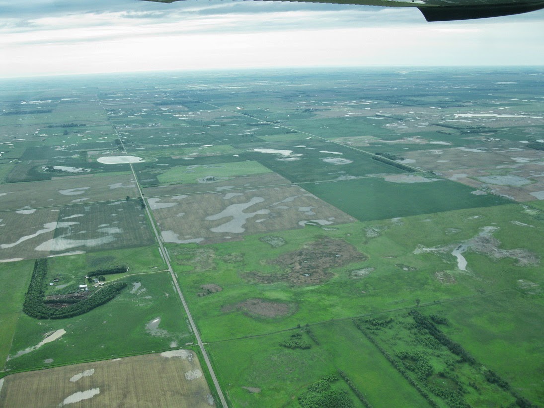
Departing Swift Current, SK.  Our last and final Canadian departure as we head toward Minot, North Dakota.

These are the storms that blocked our path east which is why we changed gears and headed south to go through customs in Minot, ND instead of Pembina, ND which is further east on the Minnesota border.

Storms to the southwest of us beginning to develop.


And they continued to build and grow. 


We had been watching out the window and on the screen inside and witnessed the speed of movement increase from 18 mph to the northeast to finally 38 mph to the southeast.  It picked up speed, changed direction and kept building.  You can see where we deviated off course to keep our distance and also I increased power to pick up speed so we could safely beat it to Aberdeen.


We're on the ground in Aberdeen with Mighty Mouse safely tucked away inside a hangar for the night.


He's been running flawlessly for the entire trip and he deserved this protection from the oncoming storm......didn't hurt his owners mindset either as we still have some distance to fly.


Things are turning nasty about now.....or as they say in the south:  It's fixin to get ugly.


And here it comes.  The wide open plains have some of the most ferocious storms you'll find anywhere on earth.

Sunday, June 22, 2014

June 22, 2014

Just a quick update which I'll expand on after we get home:

We left Swift Current, SK yesterday and went through customs at Minot, ND where we refueled and headed to Aberdeen, SD where we spent the night. 

We're headed home to Rogers, AR today but have much weather to fly around to get there.

I'll post a picture of how we'll kinda make it to Rogers today.


More tomorrow.


Jim & Cindy


Storms in Nebraska will require a wide diversion to get home today....something like this.  With weather in the cockpit, I hope to do better than this but we'll see.

Friday, June 20, 2014

Lloydminster to Swift Current, SK - June 20, 2014

We made a slight change in plans today.

Flying our original plan southeast from Lloydminster just wasn't in the cards as the weather to the east was not going to cooperate for several days.

We reviewed our options and decided to head south and cross the border and go through customs in Williston, ND and not on the Minnesota/North Dakota line in Pembina, ND.

I've filed the necessary border crossing forms tonight and received the confirmation number I need and I've received an e-mail which clears us for departure in the morning with clearance to land at Williston.

With any luck, we'll breeze through customs and be on our merry way hoping to spend tomorrow night somewhere in Nebraska (Columbus maybe?) and then a final 2 leg journey on home to Arkansas on Sunday.

I must admit we're looking forward to getting home and sleeping in our own bed.

I'll do my best to write something tomorrow night and update those following the blog.


Jim & Cindy


The view out our motel room window this morning.  It was so thick, this bird had no excuse for being out in this mess.  I really had no hope of leaving today to fly anywhere but the ceiling lifted enough for us to scoot out of town and head south.


As we flew south, we skirted the weather to the east that was blocking our progress east.  Having weather in the cockpit really helps define where you can go and more importantly.....can't go.  There was a lot of rain further east of our route.


Looking out my side of Mighty Mouse to the east with a visual of what the Garmin 796 was showing us inside the cockpit.


We landed in Swift Current, SK after a 1.9 hour flight from Lloydminster.  Swift Current will be our final resting place in Canada.  Weather permitting, we'll launch from here about 10:00 in the morning, headed to Williston, ND and our appointment with customs.


Mighty Mouse tied down in a nice shady spot for the night.  Tomorrow, we head to the US of A and all things considered......very close to home.

Thursday, June 19, 2014

Lloydminster - June 19, 2014

As you'll see from the pictures below, we'll remain in Lloydminster for a third day.

It's been 200' overcast with poor visibility for most of the day and it's not forecast to change much.

We drove out to the airport to check on the Mouse (and to help kill some time) and he's sitting there in the cold rain with a frown on his face.......I don't blame him much.  I don't think the old boy had any idea what was in store for him but he's learning all about life now.

All commercial flights in and out of Lloydmintser have been canceled for 2 days now.  They don't have an instrument landing system in place here so that's the reasoning behind the cancellations and why the commercial fliers can't get in.

While we were there, a helicopter did come in and he was flying very low to stay under the cloud deck.

So anyway, this leaves us with staying put and hoping tomorrow will be better.


Jim, Cindy and one very cold and wet Mouse.

   
Poor old Mighty Mouse sitting out in the cold, wet rain.

The ground the main gear is sitting on is on a slope and it's saturated.  I'm so glad I was able to leave the nose gear on pavement to ease the job of extricating him when we leave.

Here's the helicopter coming in.  He landed at the fuel pumps to refuel.

 
For those who know me, I'm rather partial to the Beechcraft Bonanza and here's one I found parked down the row from Mighty Mouse.  It's an early model Bonanza from the late 1940's or very early 1950's. 

And lastly, here's a Cessna 150 brother, tied down at this very wet airport.

Wednesday, June 18, 2014

Lloydminster - June 18, 2014 Part 2

I neglected to add a couple pictures to our post this morning so here's a part 2 update.


Here's the weather cam at Lloydminster airport from earlier this morning.  It's 500' overcast which is too low for our flying.  Further east and southeast there's a high percentage of thunderstorms as well and also wind gusts bumping 40 knots.

My very good friend and pilot friend back home, Robert Bell, has been tracking our progress daily and he sent this to me just this morning.  It gives some perspective and point of reference to what we've done so far.

Lloydminster, SK - June 18, 2014

To add a little more to our post from last night, after flying yesterday from Dawson Creek on the eastern edge of the Yukon Territory to Lloydminster on the eastern edge of Alberta, it looks like we'll be here waiting on the weather yet again.

Our flights (2 legs) took us across the entire width of Alberta.  We left Dawson Creek and flew past the northern side of Grand Prairie, Alberta and across mostly flat terrain into Whitecourt to refuel and get an updated weather briefing for our next leg into Lloydminster, Alberta which in on the Saskatchewan border.  This first leg was 1.9 hours and was in mostly smooth, comfortable air. 

We departed Whitecourt with full fuel and continued on our way to the east.  Our path took us just north of Edmonton, Alberta where we skirted their airspace and where we saw Edmonton's downtown buildings rising above the horizon.  From here to Lloydminster is was all prairie with farms and many pump jacks slowly working their up and down motion as they pumped oil from the ground.  This leg was a bit longer at 2.1 hours en route.

If I had to guess, we'll be here a couple days waiting on the weather.  Since we have a rental car we'll venture out and see what Lloyd has to offer.


Jim & Cindy


Since Dawson Creek is located at Mile Marker 0 on the Alaskan Highway, I really wanted a picture of Mighty Mouse parked in front of this terminal.  Dawson Creek has 2 commercial flights a day land and depart here and one of those was inbound so security would not allow me to carry out my wish.  This was the best I could do as I took the picture from inside the Mouse with the engine running.  The dark shadow in the upper right is the prop......dang it. 
Cruising along at 5,500' eastbound and enjoying not only the ride but the progress too.

This has been a very wet trip so far and we flew over quite a bit of saturated ground.

Saturated ground or not, we're putting miles and miles and miles in our rear view mirror.

The Whitecourt, AB terminal building were we talked with a weather briefer about our next leg into Lloydminster and filed our next flight plan into Lloyd.

Tuesday, June 17, 2014

Dawson Creek to Whitecourt to Lloydminster

We got a late start this morning leaving Dawson Creek due to wet weather to the east and southeast. 

This is the first time during our trip that we were able to make two legs in one day which made us feel like we made some progress.

When weather permits, we're down to 2 legs (hopefully in 1 day) where we'll spend our last night in Canada in Brandon before crossing the border and going through customs at the airport of entry in Pembina, ND which is right on the border of Minnesota.

Once through customs we'll fly south down the western sides of Minnesota, Iowa, Missouri and then slide through the final leg into Rogers, Arkansas.

The weather tomorrow looks doubtful based on what I see tonight but we'll make the call in the morning.  Here we have a rental car so at least we have a convenient way to get around as needed.

More tomorrow.


Jim & Cindy

The day began in Dawson Creek where Mighty Mouse was waiting faithfully to get back underway.  The clear sky in Dawson Creek changed to a cloud cover as we headed southeast. 

Flying along in mostly stable and smooth air, Cindy took over for some more stick time while I took it easy.

After refueling and checking the weather between Whitecourt and Lloydminster, we climbed back in and off we went.  This picture is Whitecourt on our departure climbing to 5,500' which is the altitude we flew all day.

The Garmin 796 has the capability to show weather on the moving map.  The downside is that it wasn't available through all of Alaska and all of Canada up to this point between Whitecourt and Lloydminster.  I've missed not having this capability on this trip and it's most welcome to have weather back in the cockpit.